
Khao Chao Fm
Type Locality and Naming
Khao Kling, 3 km west of km 131.8, Phet Kasem highway; reference section at Khao Ta Mong Lai, Prachuap Khiri Khan province. Proposed by Piyasin (1975), revised by Chaodumrong and others (2004, 2007) and Chaodumrong (2010), Department of Mineral Resources (2007). The formation is typically exposed at Khao Phra, c. 8 km west of Ban Don Sai in the Khao Yoi area of Phetchaburi Province, SE Thailand. Parent unit: uppermost formation in the Kaeng Krachan Gr.
Synonym: หมวดหินเขาเจ้า
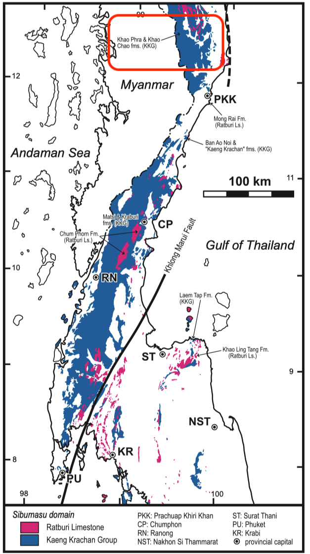
[Figure: Distribution of Carboniferous and Permian in upper, and part of lower, Peninsular Thailand. Data mainly based on 1:1 million scale geological map of Thailand (DMR 1999) with minor modifications (KKG: Kaeng Krachan Group) (Ueno & Charoentitirat, 2011).]
Lithology and Thickness
Sequence of quartz-rich sandstone, shale, siltstone and mudstone. This formation can be divided it into three parts: Lower part is well-sorted, subangular to well-rounded, thick-bedded quartz arenite to arkose, occasionally associated with tuffaceous sandstone and rhyolitic tuff. Middle part is grey, thin-bedded shale, siltstone and mudstone overlain by well-sorted, fine- to medium-grained sandstone with thin shell-beds. Upper part consists of intercalated mudstone, shale, thin-bedded sandstone and limestone. Beds of tuff, limestone, thin shells and crinoid stems are observable in the upper part of the formation. At Ban Don Sai, it is ca. 340 m thick. Its thickness is c. 520 m in the Kaeng Krachan Dam area; over 100 m at Spillway of the Kaeng Krachan Dam.
Relationships and Distribution
Lower contact
Khao Phra Fm (conformable)
Upper contact
Conformably overlain by the Phap Pha Fm of Ratburi Gr (Chaodumrong and others, 2004, 2007) /Ratburi Limestone Fm (Ueno & Charoentitirat, 2011) (conformable)
Regional extent
GeoJSON
Fossils
Bryozoans Fenestella sp. and Polypora sp. and the brachiopod Spirifer sp; An Artinskian (Yakhtashian) brachiopod fauna yielding Meekella bisculpa and Costatumulus sp.
Age
Depositional setting
Additional Information